Throughout much of the Trans-Pecos of Texas across the counties of El Paso, Hudspeth, Culberson, Jeff Davis, Presidio, Brewster, Reeves, Pecos, and Terrell, indeed the entirety of the Big Country bounded by the Pecos River, the New Mexico state line, and the Rio Grande, the preponderance of the land’s natural features appeal to plein air artists, geologists, and outdoor photographers. An old tale (and ain’t all the good ones “old tales”?) that has been retold countless times in the Big Bend relates that after the Great Creator made the world, the enormous amount of leftover material was swept up in an even bigger cosmic dustbin and tossed out. From the cosmos, all that debris made landfall and created the mountains of northern Chihuahua, the Big Bend, and eastern Coahuila. Dust particles from that debris scattered throughout the wider region, and there you have it, the razor-thin line between folklore and geology to provide an insight to explain how those mountains and the landscape came to be.
Not a few years after that dust had settled, spanning a number of millennia, human beings first appeared in greater region, following the rivers in pursuit of game and creating new trails across the land. Much later, the earth their feet trod was crossed by other feet, and then the wooden wheels of wagons, which later were covered with asphalt by hardworking crews to build the paucity of roads in the Trans-Pecos. Just for the hell of it, we ought to rightfully and firmly credit Mr. Amon G. Carter, Sr. of Fort Worth for promoting that part of West Texas as well. But for the moment, the handful of Farm-to-Market roads, State highways, and a bit of interstate roadways deserve a little consideration, while I kindly ask Mr. Carter to cool his heels a bit; I’ll get back to him soon.

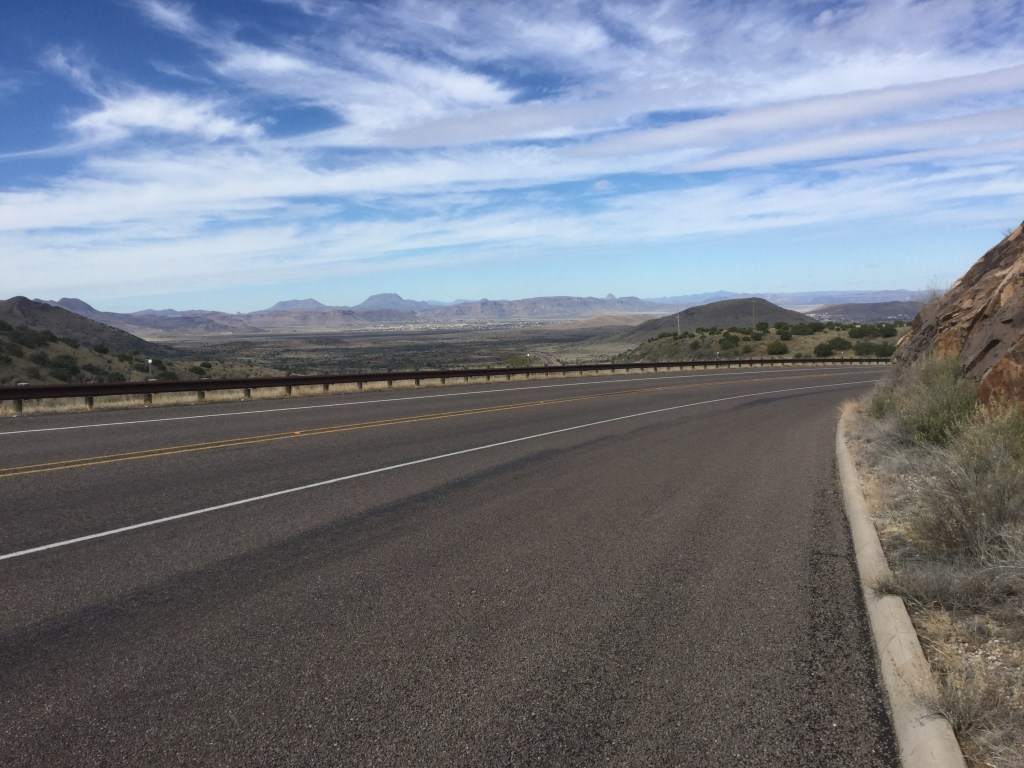
From the thirty-thousand-foot view from above, or through a close study of topographical maps of the region’s many quadrants, a pattern begins to emerge regarding the paths of paved and unpaved roads in the Big Bend. They tend to stretch along for miles like a strand of dry spaghetti, and then elsewhere they dip and curve and rise to wend their way around the geological uplifts and arroyos that sculpt the land. That debris from antiquity bedeviled the Texas Highway Department when its surveyors attempted to devise a system of roads through this creosote haven. And yet, one can drive to and near any number of corners of the Trans-Pecos to see its peculiar beauty.


Fortunately, though, barbed wire fences, heat, aridity, and all measures of thorns, spines, fangs, and claws encourage most wayfarers to stick close to the blacktop; hence, the thin spider web of automobile pavement across the region preserves the natural habitat and keeps us two-legged animals at bay. I suppose for too many passers-through there’s no harm in zipping over this land as fast as possible to reach their destinations far beyond. But as far as I can tell, without a doubt you gain more when you slow down and actually look at the land as you drive. Whether the asphalt under your wheels is Texas 118, US 67, Interstate 10, or FM 1111, such roads interact with the landscape. At dawn and dusk, the color of light dividing Earth and Sky reflects off the faces of mountains and mesas. At the meridian, the light, especially in summer, washes out the rich color palette to create its own resplendence. And the road goes on.


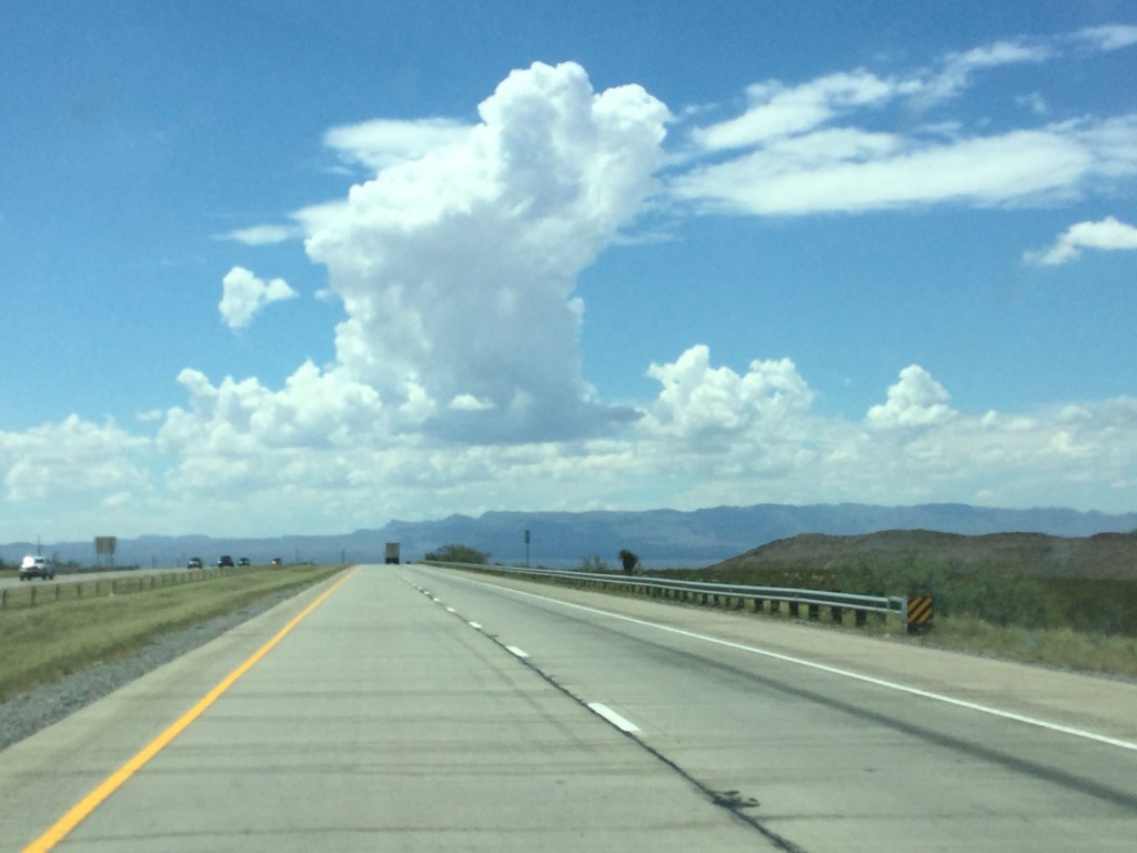
Unencumbered by tall trees and taller buildings, the fortunate driver is afforded views of an ever-changing, often dramatic sky. If the road is worthy of John Steinbeck, the sky likewise beckons Georgia O’Keefe and Ansel Adams. The entire gamut of cloud formations reveal themselves throughout the seasons, and one is fortunate to be under those skies at those exact fleeting moments to witness the Ultimate Grand Lady’s creativity. In the monsoon season of May, June, and July, mighty thunderheads build up high in the atmosphere, yet during the other nine months threadbare, stretched-out wisps resembling skinny cows in search of water on a dry plain fill that desert sky. No two moments are quite the same, and as Townes Van Zandt observed, “Time flies like an arrow. Fruit flies like a banana.”
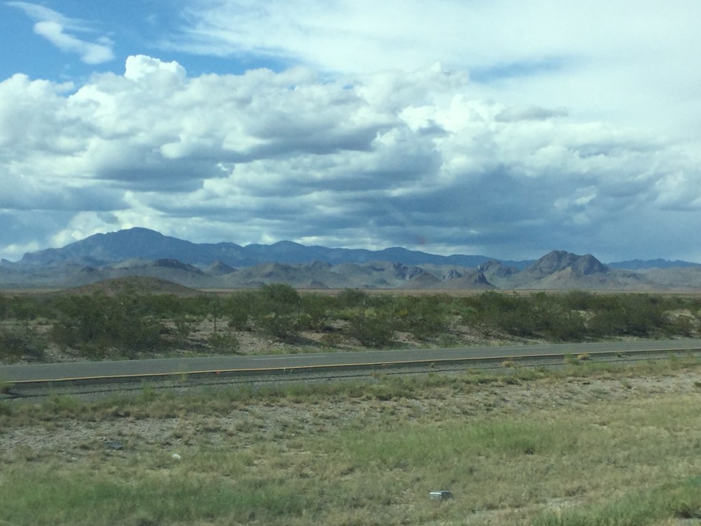
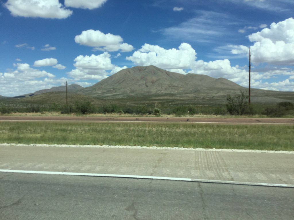
You have to be there with eyes willing to absorb and translate the gifts from the trade winds and heat thermals to appreciate a landscape and sky unlike urban Texas. Think Dallas and Houston, man. But the Big Empty offers something unfound east of Interstate 35 – an ancient testament to the master craftsmen that does not exist in the geology on the other side of the Lone Star State. Sky-reaching buildings may be oh so terribly few between the Pecos and the Rio Grande, but skyscrapers rise in the Trans-Pecos despite the envy of those who think this land is undeserving of such. Out here, Precambrian strata carry more weight than the International Style of architecture; or, more precisely, Cathedral Mountain south of Alpine exhibits more interesting architectural features than the Seagram Building in New York City or the Sears Tower in Chicago – even if Cameron, Sloane, and Farris are looking over that city high atop from the observation deck. Geology: the original architecture. With apologies to the great writer Norman Maclean, “I am haunted by desert vistas.”
In remembrance and honor of Dr. Michael Anthony Jones and Mrs. Sylvia Jones